 Hydrohistorian
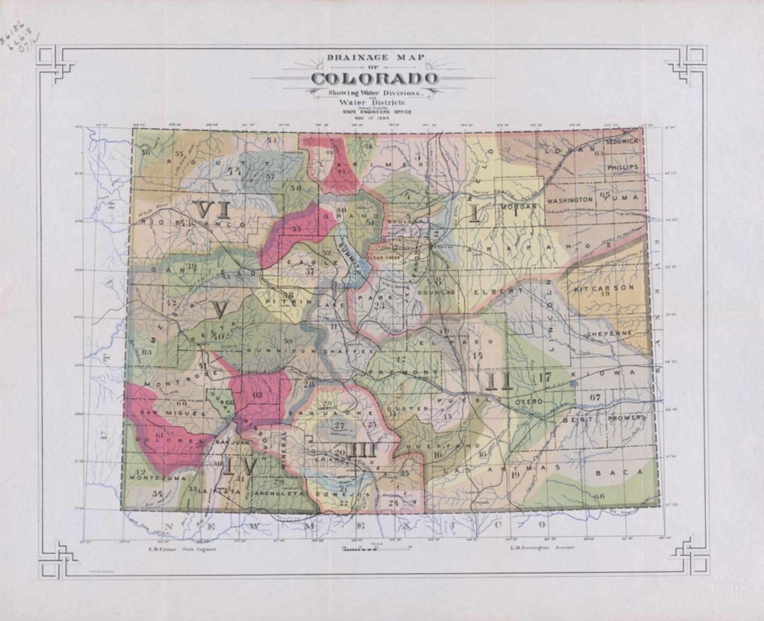
Drainage map of Colorado showing water divisions and water districts
University of Colorado Boulder Libraries, via the Digital Public Library of America and Wikimedia Commons · 1894 · C.B. Cromer, State Engineer; L.M. Cunningham, Assistant
University of Colorado Boulder Libraries, via the Digital Public Library of America and Wikimedia Commons Public domain. Archive record ↗ · Rights
Source Archival record · verify at University of Colorado Boulder Libraries, via the Digital Public Library of America and Wikimedia Commons ↗
The State Engineer's own map of the system this whole site is organised by, drawn in 1894. Six divisions, numbered districts, every boundary following a drainage rather than a county line.
Shows: Colorado's water administration as its own office drew it, thirteen years after the districts were created.
What this does not let you conclude: The system as it stands. There are SEVEN divisions now, not six, and district boundaries and numbers have both changed -- so this is the ancestor of the map on these pages, not a version of it. The cartouche reads 'Issued from the State Engineer's Office, Nov. 1st 1894'.
Placed on
- Topic rights · hero