 Hydrohistorian
Plat of Water District No. 10 — State Engineer's biennial report, 1893-1894 (Part II)
Internet Archive · 1893-1894 · Colorado Office of the State Engineer
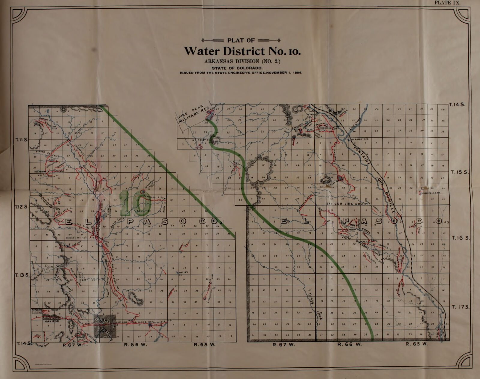
Biennial report of the State Engineer to the Governor of Colorado for the years 1893 and 1894, Part II. Colorado Office of the State Engineer; digitised by Colorado State Publications Library, Internet Archive biennialreportofcolo_4. Public domain. Archive record ↗ · Rights
Source Archival record · verify at Internet Archive ↗ Source Probable join · The plate's own title block reads “Water District No. 10”; it is filed on DWR's Water District 10 (Fountain Creek) of today, which carries the same number.
The State Engineer's own map of Water District No. 10 — today's Fountain Creek — drawn for the 1893-1894 biennial report, every decreed ditch on it.
Shows: Which ditches the State Engineer's office recorded in Water District No. 10 in 1893-1894, and where they took their water; the district's extent as the office drew it then.
What this does not let you conclude: The district's boundary today: water-district lines have been redrawn since, and the division number printed on the plate is the division numbering of the time, not DWR's. Nothing on the plate says which of these ditches still runs, or what any of them diverts now. The years the report covers; the plates were issued with it.
Placed on
- District d2_wd10_fountain_creek · gallery · our placement, by name and place
- Division 2 · gallery · our placement, by name and place
- Topic rights · gallery