 Hydrohistorian
← My Water · All ditches in this district · Print / save as PDF ·
· every download of this record carries its certificate idSNAKE RIVER DITCH
Structure dossier · WDID 3600805 · DITCH · SNAKE RIVER · DWR record
Snake River Ditch is a ditch on Snake River in Colorado. This page is its public record: the water it has a right to, whether it may take it today, and its history, compiled from the Colorado Division of Water Resources.
Source DWR administrative record · verify at DWR structure ↗ Source DWR administrative record · verify at DWR diversion records ↗ Source Our computation, scored against a reference · scored against DWR's call analysis, see /methods
Where this page's figures come from
Generated 2026-10-21 15:57 by Hydrohistorian. Sources: DWR HydroBase snapshot HydroBase_CO_20260928 (history) + CDSS REST (current), USGS NWIS cross-checks. Engine v0.5.0 (71f534c) — every figure regenerates from this named code version and data image.
The record and the river
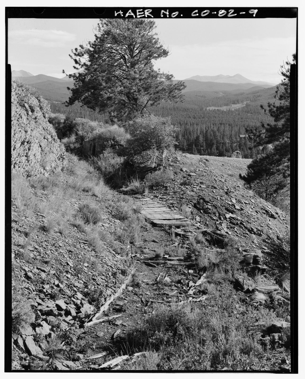
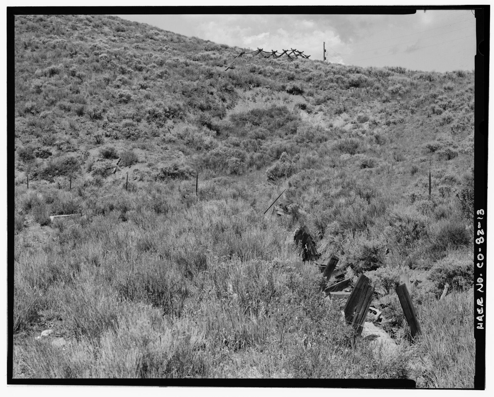
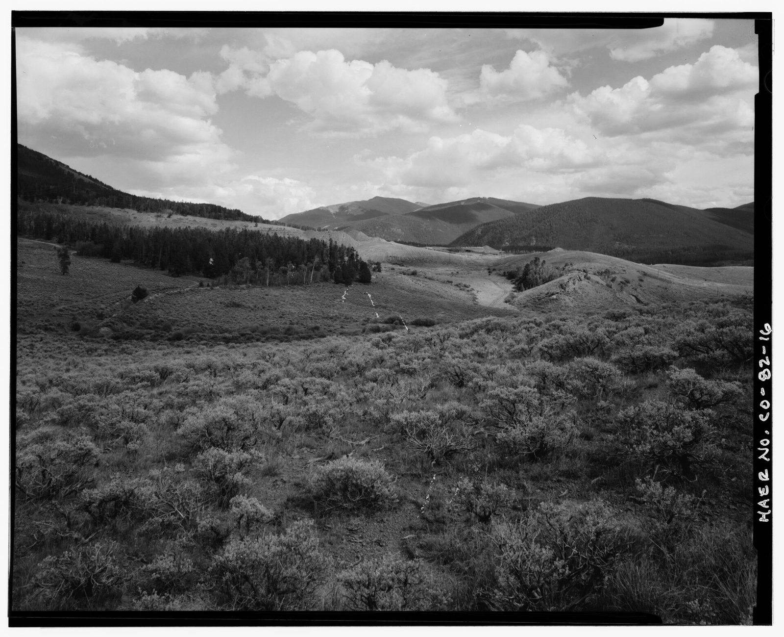
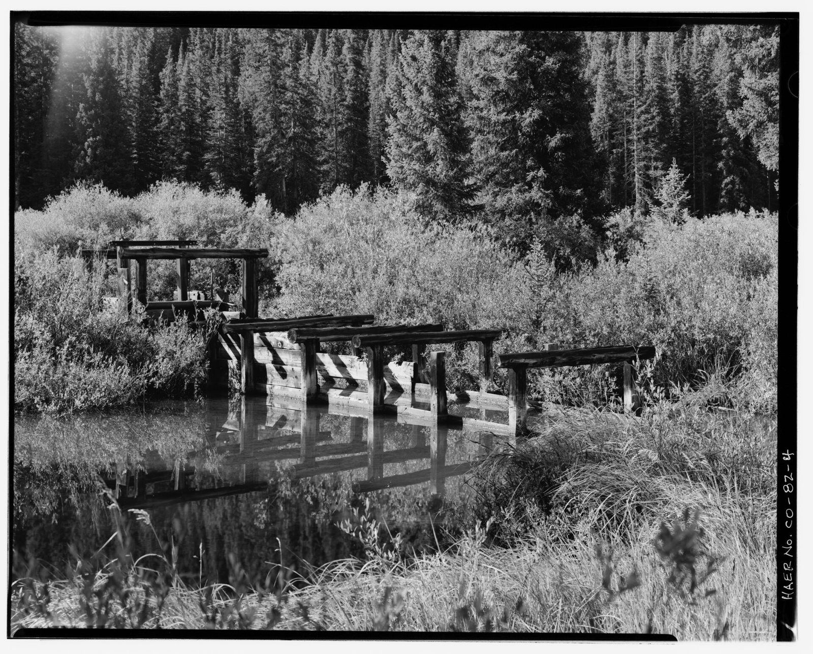
- Senior appropriation
- 1899-10-11
Source Adjudicated record · verify at DWR net amounts ↗ - Decreed rate, absolute
- 0.57 cfs
Source Adjudicated record · verify at DWR net amounts ↗ - Diversion record on file
- 1963–1985
Source DWR administrative record · verify at DWR diversion records ↗
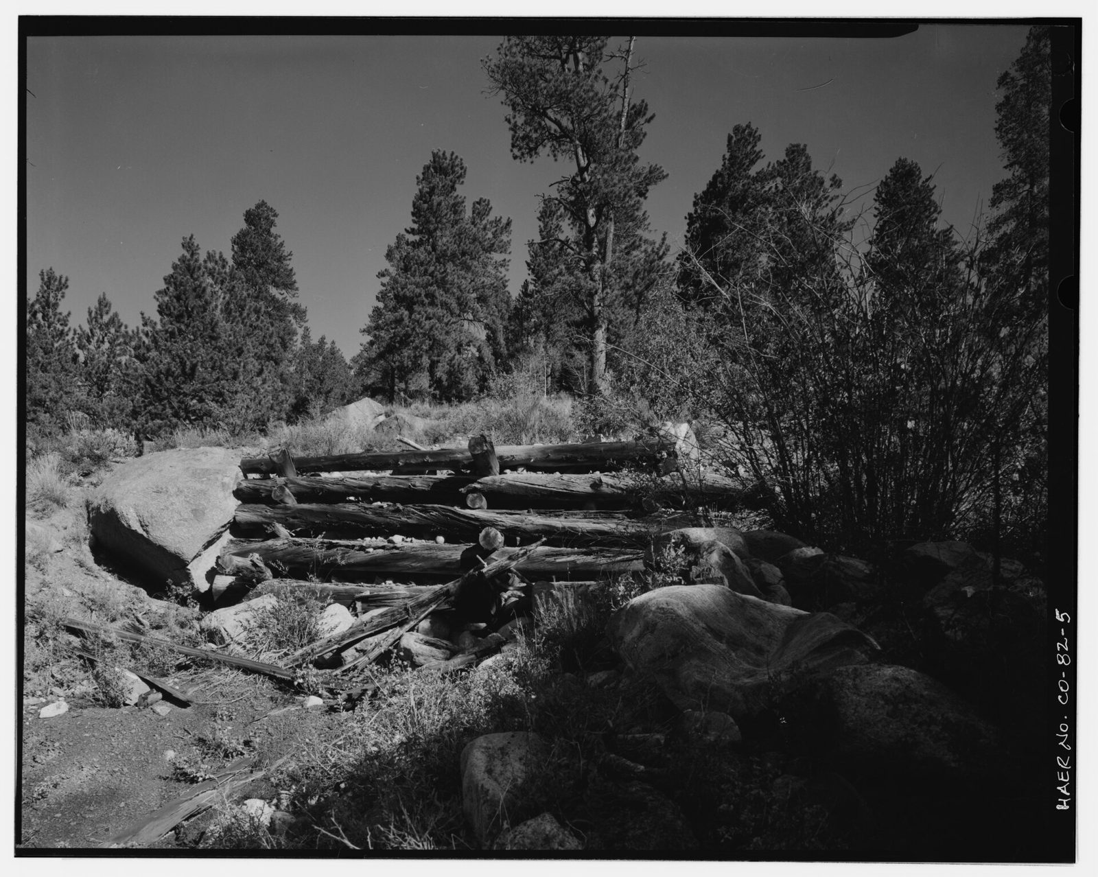
The photographs are what the archive says they are; the numbers are what DWR’s record says today. Neither corrects the other.
Where this structure is measured
| Gage | Flowing now | Record | How we know |
|---|---|---|---|
| SNAKE RIVER NEAR MONTEZUMA, CO. SNAMONCO | 18.9 cfs | 1942–2026, 25,621 days | co-located, 168 m |
A green link is DWR's own: either its telemetry inventory maps this WDID to that station, or the station is named for this WDID (0700553 → 0700553A). An amber one is ours — the station sits within 250 m and shares a distinctive word with this structure's name, which is a strong hint rather than a DWR statement that this gage meters this structure. Wrong? Tell us.
In short
SNAKE RIVER DITCH holds 1 decreed right on SNAKE RIVER. No active call senior to its rights reaches its district today (25 active calls checked), so it is in priority now. 21 further calls state no district and sit outside this one, so they are counted here rather than assumed either way. That is today's position; the weeks ahead cannot be projected for it: no call in the record verifiably applies to this district (statements and caller locations checked). In a median year over its last 15 recorded years it diverts 1,431 acre-feet. That use is falling by about 83.5 acre-feet a year over 15 years (p=0.022821503671488053). It was a party to 2 court cases that also touched 6 other structures.
Assembled from the figures on this page — every number above is checked against them before it is shown (10 checked). The detail, with its method, is in the cards below.
Download this structure
Everything on this page as data you can work with — and a README that makes it citable: the HydroBase snapshot it was built from, the build commit, what every column means, the method behind each derived figure, and that method's stated limits.
⇩ Full record (.zip) Print / save as PDF
Or one table at a time: rights.csv · annual_use.csv · curtailment_now.csv · court_cases.csv · co_parties.csv · call_climatology.csv
What is in the bundle
rights.csv— every decreed right, most senior first, with admin numbers, dates, amounts, uses and case numbers.annual_use.csv— recorded diversion by year, with releases accounted separately.curtailment_now.csv— each right's current priority status and how often it was out across analog years.court_cases.csv— the cases attached to its rights.co_parties.csv— the other structures that were parties to those cases. Not available anywhere else.call_climatology.csv— how often each right has been out of priority by week of season, with confidence intervals and the seasons the record could actually judge.README.txt— provenance, methods, limits, disclaimer, and links back to DWR's own records for verification.
Where it sits
Location as DWR records it (diversion). Faint dots are the neighbouring water; click any to open it.
Current administration
● In priority — no active call senior to this structure's rights affects its district (25 active call(s) checked).
21 further calls state no district and sit outside this one, so they are counted here rather than assumed either way.
Which of its rights are out of priority?
The outlook for the weeks ahead is not computable for this structure: no call in the record verifiably applies to this district (statements and caller locations checked). Today’s position is a separate question, and it is answered in Current administration above — that screen reads the district’s active calls and needs no reference gage.
Where it sits in line
Priority 1899-10-11 — 175th most senior of the 1247 structures with decreed rights in this water districtDWR's administrative subdivision of a river basin; the unit calls are usually stated in..
Under prior appropriationColorado's rule for sharing water: first in time, first in right. Age decides, not proximity or need., everything ahead of it in this line is satisfied in full before it receives any water. Immediately ahead: VIE DITCH (1899-08-31). Immediately behind: OWNERS WELL NO 1 (1899-10-11).
On SNAKE RIVER at river mile 57.7, it is 22nd of 50 down the reach. Immediately upstream: MILL CREEK DIVERSION NO 1. Immediately downstream: KEYSTONE SNOWLINE DITCH.
Position on the modelled network, not a claim about whose water this is — a stream carries water from many rights at once, and diverted water returns to it.
Decreed rights (1)
| Admin noDWR's numeric encoding of a water right's seniority. Smaller is more senior; the integer part counts days from 1849-12-31 to the date that ranks the right. | AppropriatedWhen water was first put to beneficial use. It sets seniority unless a prior adjudication date is later. | AdjudicatedWhen the water court confirmed the right. A use decreed in 1975 was not a decreed use in 1955, however old the appropriation is. | AbsoluteA right actually put to use, as opposed to conditional -- a placeholder for a use not yet made. | ConditionalA right reserving a place in line for a use not yet made; it must be diligently pursued or it lapses. | Alt-pointAn absolute amount decreed at another structure that may be diverted here instead -- an alternate point of diversion or an exchange. DWR calls this the APEX amount; a right showing 0.0 absolute but an alt-point amount is exercised here under another structure's decree. | Decreed forWhat the court said this water may be used for -- irrigation, municipal supply, augmentation and so on. | Case |
|---|---|---|---|---|---|---|---|
| 18181.00000 | 1899-10-11 | 1910-03-02 | 0.575 cfs | 0.0 | — | Power generation | 37 |
Amounts marked cfs are flow rates; AF are stored volumes (storage rights are decreed in acre-feet). An absolute amount of 0.0 beside an alt-point amount is not a dead right: the water is decreed at another structure, and that row records permission to divert it here instead (an alternate point or exchange). A case listing several numbers reflects the original decree plus later change cases.
How much of this decree was in priority, by day
A right is in priority on a day when it is senior to every call administering this structure. Of its 0.575 cfs decreed rate, the average day over the last 6 year(s) had 0.575 cfs in priority (100% of the decree). No call in effect is a free river — that was 1.7% of days.
Calls are set and released at a time of day, not at midnight, so a day is counted by the hour: a call setting at 4pm costs that day a third of its rate, not all of it. A call began or ended mid-day on 8 of these days.
This is paper water. It is the decreed rate that was in priority — not water that was physically in the stream, and not water this structure diverted. A ditch can be in priority for 50 cfs on a day the creek carries five. What that distinction means →
| Year | Mean in priority (Apr–Sep) | Share of decree | Free-river days | Days fully out |
|---|---|---|---|---|
| 2026 | 0.58 cfs | 100% | 0 | 0 |
| 2025 | 0.58 cfs | 100% | 0 | 0 |
| 2024 | 0.58 cfs | 100% | 4 | 0 |
| 2023 | 0.58 cfs | 100% | 27 | 0 |
| 2022 | 0.58 cfs | 100% | 0 | 0 |
| 2021 | 0.58 cfs | 100% | 0 | 0 |
Show the last 120 days, day by day
| Date | In priority | Controlling call |
|---|---|---|
| 2026-10-20 | 0.575 cfs (100%) | SHOSHONE POWER PLANT, 1905-12-05 · Colorado River · on a river this source flows into |
| 2026-10-19 | 0.575 cfs (100%) | SHOSHONE POWER PLANT, 1905-12-05 · Colorado River · on a river this source flows into |
| 2026-10-18 | 0.575 cfs (100%) | SHOSHONE POWER PLANT, 1905-12-05 · Colorado River · on a river this source flows into |
| 2026-10-17 | 0.575 cfs (100%) | SHOSHONE POWER PLANT, 1905-12-05 · Colorado River · on a river this source flows into |
| 2026-10-16 | 0.575 cfs (100%) | SHOSHONE POWER PLANT, 1905-12-05 · Colorado River · on a river this source flows into |
| 2026-10-15 | 0.575 cfs (100%) | SHOSHONE POWER PLANT, 1905-12-05 · Colorado River · on a river this source flows into |
| 2026-10-14 | 0.575 cfs (100%) | GRAND VALLEY CANAL, 1912-03-25 · Colorado River · on a river this source flows into |
| 2026-10-13 | 0.575 cfs (100%) | GRAND VALLEY CANAL, 1912-03-25 · Colorado River · on a river this source flows into |
| 2026-10-12 | 0.575 cfs (100%) | GRAND VALLEY CANAL, 1912-03-25 · Colorado River · on a river this source flows into |
| 2026-10-11 | 0.575 cfs (100%) | GRAND VALLEY CANAL, 1912-03-25 · Colorado River · on a river this source flows into |
| 2026-10-10 | 0.575 cfs (100%) | GRAND VALLEY CANAL, 1912-03-25 · Colorado River · on a river this source flows into |
| 2026-10-09 | 0.575 cfs (100%) | GRAND VALLEY CANAL, 1912-03-25 · Colorado River · on a river this source flows into |
| 2026-10-08 | 0.575 cfs (100%) | GRAND VALLEY CANAL, 1912-03-25 · Colorado River · on a river this source flows into |
| 2026-10-07 | 0.575 cfs (100%) | GRAND VALLEY CANAL, 1912-03-25 · Colorado River · on a river this source flows into |
| 2026-10-06 | 0.575 cfs (100%) | GRAND VALLEY CANAL, 1912-03-25 · Colorado River · on a river this source flows into |
| 2026-10-05 | 0.575 cfs (100%) | GRAND VALLEY CANAL, 1912-03-25 · Colorado River · on a river this source flows into |
| 2026-10-04 | 0.575 cfs (100%) | GRAND VALLEY CANAL, 1912-03-25 · Colorado River · on a river this source flows into |
| 2026-10-03 | 0.575 cfs (100%) | GRAND VALLEY CANAL, 1912-03-25 · Colorado River · on a river this source flows into |
| 2026-10-02 | 0.575 cfs (100%) | GRAND VALLEY CANAL, 1912-03-25 · Colorado River · on a river this source flows into |
| 2026-10-01 | 0.575 cfs (100%) | GRAND VALLEY CANAL, 1912-03-25 · Colorado River · on a river this source flows into |
| 2026-09-30 | 0.575 cfs (100%) | GRAND VALLEY CANAL, 1912-03-25 · Colorado River · on a river this source flows into |
| 2026-09-29 | 0.575 cfs (100%) | GRAND VALLEY CANAL, 1912-03-25 · Colorado River · on a river this source flows into |
| 2026-09-28 | 0.575 cfs (100%) | GRAND VALLEY CANAL, 1912-03-25 · Colorado River · on a river this source flows into |
| 2026-09-27 | 0.575 cfs (100%) | GRAND VALLEY CANAL, 1912-03-25 · Colorado River · on a river this source flows into |
| 2026-09-26 | 0.575 cfs (100%) | GRAND VALLEY CANAL, 1912-03-25 · Colorado River · on a river this source flows into |
| 2026-09-25 | 0.575 cfs (100%) | SHOSHONE POWER PLANT, 1905-12-05 · Colorado River · on a river this source flows into |
| 2026-09-24 | 0.575 cfs (100%) | SHOSHONE POWER PLANT, 1905-12-05 · Colorado River · on a river this source flows into |
| 2026-09-23 | 0.575 cfs (100%) | SHOSHONE POWER PLANT, 1905-12-05 · Colorado River · on a river this source flows into |
| 2026-09-22 | 0.575 cfs (100%) | SHOSHONE POWER PLANT, 1905-12-05 · Colorado River · on a river this source flows into |
| 2026-09-21 | 0.575 cfs (100%) | SHOSHONE POWER PLANT, 1905-12-05 · Colorado River · on a river this source flows into |
| 2026-09-20 | 0.575 cfs (100%) | GRAND VALLEY CANAL, 1912-03-25 · Colorado River · on a river this source flows into |
| 2026-09-19 | 0.575 cfs (100%) | GRAND VALLEY CANAL, 1912-03-25 · Colorado River · on a river this source flows into |
| 2026-09-18 | 0.575 cfs (100%) | SHOSHONE POWER PLANT, 1905-12-05 · Colorado River · on a river this source flows into |
| 2026-09-17 | 0.575 cfs (100%) | SHOSHONE POWER PLANT, 1905-12-05 · Colorado River · on a river this source flows into |
| 2026-09-16 | 0.575 cfs (100%) | SHOSHONE POWER PLANT, 1905-12-05 · Colorado River · on a river this source flows into |
| 2026-09-15 | 0.575 cfs (100%) | SHOSHONE POWER PLANT, 1905-12-05 · Colorado River · on a river this source flows into |
| 2026-09-14 | 0.575 cfs (100%) | SHOSHONE POWER PLANT, 1905-12-05 · Colorado River · on a river this source flows into |
| 2026-09-13 | 0.575 cfs (100%) | SHOSHONE POWER PLANT, 1905-12-05 · Colorado River · on a river this source flows into |
| 2026-09-12 | 0.575 cfs (100%) | SHOSHONE POWER PLANT, 1905-12-05 · Colorado River · on a river this source flows into |
| 2026-09-11 | 0.575 cfs (100%) | GRAND VALLEY CANAL, 1912-03-25 · Colorado River · on a river this source flows into |
| 2026-09-10 | 0.575 cfs (100%) | GRAND VALLEY CANAL, 1912-03-25 · Colorado River · on a river this source flows into |
| 2026-09-09 | 0.575 cfs (100%) | GRAND VALLEY CANAL, 1912-03-25 · Colorado River · on a river this source flows into |
| 2026-09-08 | 0.575 cfs (100%) | GRAND VALLEY CANAL, 1912-03-25 · Colorado River · on a river this source flows into |
| 2026-09-07 | 0.575 cfs (100%) | GRAND VALLEY CANAL, 1912-03-25 · Colorado River · on a river this source flows into |
| 2026-09-06 | 0.575 cfs (100%) | GRAND VALLEY CANAL, 1912-03-25 · Colorado River · on a river this source flows into |
| 2026-09-05 | 0.575 cfs (100%) | GRAND VALLEY CANAL, 1912-03-25 · Colorado River · on a river this source flows into |
| 2026-09-04 | 0.575 cfs (100%) | GRAND VALLEY CANAL, 1912-03-25 · Colorado River · on a river this source flows into |
| 2026-09-03 | 0.575 cfs (100%) | GRAND VALLEY CANAL, 1912-03-25 · Colorado River · on a river this source flows into |
| 2026-09-02 | 0.575 cfs (100%) | GRAND VALLEY CANAL, 1912-03-25 · Colorado River · on a river this source flows into |
| 2026-09-01 | 0.575 cfs (100%) | SHOSHONE POWER PLANT, 1905-12-05 · Colorado River · on a river this source flows into |
| 2026-08-31 | 0.575 cfs (100%) | SHOSHONE POWER PLANT, 1905-12-05 · Colorado River · on a river this source flows into |
| 2026-08-30 | 0.575 cfs (100%) | SHOSHONE POWER PLANT, 1905-12-05 · Colorado River · on a river this source flows into |
| 2026-08-29 | 0.575 cfs (100%) | SHOSHONE POWER PLANT, 1905-12-05 · Colorado River · on a river this source flows into |
| 2026-08-28 | 0.575 cfs (100%) | SHOSHONE POWER PLANT, 1905-12-05 · Colorado River · on a river this source flows into |
| 2026-08-27 | 0.575 cfs (100%) | SHOSHONE POWER PLANT, 1905-12-05 · Colorado River · on a river this source flows into |
| 2026-08-26 | 0.575 cfs (100%) | SHOSHONE POWER PLANT, 1905-12-05 · Colorado River · on a river this source flows into |
| 2026-08-25 | 0.575 cfs (100%) | SHOSHONE POWER PLANT, 1905-12-05 · Colorado River · on a river this source flows into |
| 2026-08-24 | 0.575 cfs (100%) | SHOSHONE POWER PLANT, 1905-12-05 · Colorado River · on a river this source flows into |
| 2026-08-23 | 0.575 cfs (100%) | SHOSHONE POWER PLANT, 1905-12-05 · Colorado River · on a river this source flows into |
| 2026-08-22 | 0.575 cfs (100%) | SHOSHONE POWER PLANT, 1905-12-05 · Colorado River · on a river this source flows into |
| 2026-08-21 | 0.575 cfs (100%) | SHOSHONE POWER PLANT, 1905-12-05 · Colorado River · on a river this source flows into |
| 2026-08-20 | 0.575 cfs (100%) | SHOSHONE POWER PLANT, 1905-12-05 · Colorado River · on a river this source flows into |
| 2026-08-19 | 0.575 cfs (100%) | SHOSHONE POWER PLANT, 1905-12-05 · Colorado River · on a river this source flows into |
| 2026-08-18 | 0.575 cfs (100%) | SHOSHONE POWER PLANT, 1905-12-05 · Colorado River · on a river this source flows into |
| 2026-08-17 | 0.575 cfs (100%) | SHOSHONE POWER PLANT, 1905-12-05 · Colorado River · on a river this source flows into |
| 2026-08-16 | 0.575 cfs (100%) | SHOSHONE POWER PLANT, 1905-12-05 · Colorado River · on a river this source flows into |
| 2026-08-15 | 0.575 cfs (100%) | SHOSHONE POWER PLANT, 1905-12-05 · Colorado River · on a river this source flows into |
| 2026-08-14 | 0.575 cfs (100%) | SHOSHONE POWER PLANT, 1905-12-05 · Colorado River · on a river this source flows into |
| 2026-08-13 | 0.575 cfs (100%) | SHOSHONE POWER PLANT, 1905-12-05 · Colorado River · on a river this source flows into |
| 2026-08-12 | 0.575 cfs (100%) | SHOSHONE POWER PLANT, 1905-12-05 · Colorado River · on a river this source flows into |
| 2026-08-11 | 0.575 cfs (100%) | SHOSHONE POWER PLANT, 1905-12-05 · Colorado River · on a river this source flows into |
| 2026-08-10 | 0.575 cfs (100%) | SHOSHONE POWER PLANT, 1905-12-05 · Colorado River · on a river this source flows into |
| 2026-08-09 | 0.575 cfs (100%) | SHOSHONE POWER PLANT, 1905-12-05 · Colorado River · on a river this source flows into |
| 2026-08-08 | 0.575 cfs (100%) | SHOSHONE POWER PLANT, 1905-12-05 · Colorado River · on a river this source flows into |
| 2026-08-07 | 0.575 cfs (100%) | GRAND VALLEY CANAL, 1912-03-25 · Colorado River · on a river this source flows into |
| 2026-08-06 | 0.575 cfs (100%) | GRAND VALLEY CANAL, 1912-03-25 · Colorado River · on a river this source flows into |
| 2026-08-05 | 0.575 cfs (100%) | GRAND VALLEY CANAL, 1912-03-25 · Colorado River · on a river this source flows into |
| 2026-08-04 | 0.575 cfs (100%) | GRAND VALLEY CANAL, 1912-03-25 · Colorado River · on a river this source flows into |
| 2026-08-03 | 0.575 cfs (100%) | GRAND VALLEY CANAL, 1912-03-25 · Colorado River · on a river this source flows into |
| 2026-08-02 | 0.575 cfs (100%) | GRAND VALLEY CANAL, 1934-08-03 · Colorado River · on a river this source flows into |
| 2026-08-01 | 0.575 cfs (100%) | GRAND VALLEY CANAL, 1934-08-03 · Colorado River · on a river this source flows into |
| 2026-07-31 | 0.575 cfs (100%) | SHOSHONE POWER PLANT, 1905-12-05 · Colorado River · on a river this source flows into |
| 2026-07-30 | 0.575 cfs (100%) | SHOSHONE POWER PLANT, 1905-12-05 · Colorado River · on a river this source flows into |
| 2026-07-29 | 0.575 cfs (100%) | SHOSHONE POWER PLANT, 1905-12-05 · Colorado River · on a river this source flows into |
| 2026-07-28 | 0.575 cfs (100%) | SHOSHONE POWER PLANT, 1905-12-05 · Colorado River · on a river this source flows into |
| 2026-07-27 | 0.575 cfs (100%) | SHOSHONE POWER PLANT, 1905-12-05 · Colorado River · on a river this source flows into |
| 2026-07-26 | 0.575 cfs (100%) | SHOSHONE POWER PLANT, 1905-12-05 · Colorado River · on a river this source flows into |
| 2026-07-25 | 0.575 cfs (100%) | SHOSHONE POWER PLANT, 1905-12-05 · Colorado River · on a river this source flows into |
| 2026-07-24 | 0.575 cfs (100%) | SHOSHONE POWER PLANT, 1905-12-05 · Colorado River · on a river this source flows into |
| 2026-07-23 | 0.575 cfs (100%) | SHOSHONE POWER PLANT, 1905-12-05 · Colorado River · on a river this source flows into |
| 2026-07-22 | 0.575 cfs (100%) | SHOSHONE POWER PLANT, 1905-12-05 · Colorado River · on a river this source flows into |
| 2026-07-21 | 0.575 cfs (100%) | SHOSHONE POWER PLANT, 1905-12-05 · Colorado River · on a river this source flows into |
| 2026-07-20 | 0.575 cfs (100%) | SHOSHONE POWER PLANT, 1905-12-05 · Colorado River · on a river this source flows into |
| 2026-07-19 | 0.575 cfs (100%) | SHOSHONE POWER PLANT, 1905-12-05 · Colorado River · on a river this source flows into |
| 2026-07-18 | 0.575 cfs (100%) | SHOSHONE POWER PLANT, 1905-12-05 · Colorado River · on a river this source flows into |
| 2026-07-17 | 0.575 cfs (100%) | SHOSHONE POWER PLANT, 1905-12-05 · Colorado River · on a river this source flows into |
| 2026-07-16 | 0.575 cfs (100%) | SHOSHONE POWER PLANT, 1905-12-05 · Colorado River · on a river this source flows into |
| 2026-07-15 | 0.575 cfs (100%) | SHOSHONE POWER PLANT, 1905-12-05 · Colorado River · on a river this source flows into |
| 2026-07-14 | 0.575 cfs (100%) | SHOSHONE POWER PLANT, 1905-12-05 · Colorado River · on a river this source flows into |
| 2026-07-13 | 0.575 cfs (100%) | SHOSHONE POWER PLANT, 1905-12-05 · Colorado River · on a river this source flows into |
| 2026-07-12 | 0.575 cfs (100%) | SHOSHONE POWER PLANT, 1905-12-05 · Colorado River · on a river this source flows into |
| 2026-07-11 | 0.575 cfs (100%) | SHOSHONE POWER PLANT, 1905-12-05 · Colorado River · on a river this source flows into |
| 2026-07-10 | 0.575 cfs (100%) | SHOSHONE POWER PLANT, 1905-12-05 · Colorado River · on a river this source flows into |
| 2026-07-09 | 0.575 cfs (100%) | SHOSHONE POWER PLANT, 1905-12-05 · Colorado River · on a river this source flows into |
| 2026-07-08 | 0.575 cfs (100%) | SHOSHONE POWER PLANT, 1905-12-05 · Colorado River · on a river this source flows into |
| 2026-07-07 | 0.575 cfs (100%) | SHOSHONE POWER PLANT, 1905-12-05 · Colorado River · on a river this source flows into |
| 2026-07-06 | 0.575 cfs (100%) | SHOSHONE POWER PLANT, 1905-12-05 · Colorado River · on a river this source flows into |
| 2026-07-05 | 0.575 cfs (100%) | SHOSHONE POWER PLANT, 1905-12-05 · Colorado River · on a river this source flows into |
| 2026-07-04 | 0.575 cfs (100%) | SHOSHONE POWER PLANT, 1905-12-05 · Colorado River · on a river this source flows into |
| 2026-07-03 | 0.575 cfs (100%) | SHOSHONE POWER PLANT, 1905-12-05 · Colorado River · on a river this source flows into |
| 2026-07-02 | 0.575 cfs (100%) | SHOSHONE POWER PLANT, 1905-12-05 · Colorado River · on a river this source flows into |
| 2026-07-01 | 0.575 cfs (100%) | SHOSHONE POWER PLANT, 1905-12-05 · Colorado River · on a river this source flows into |
| 2026-06-30 | 0.575 cfs (100%) | SHOSHONE POWER PLANT, 1905-12-05 · Colorado River · on a river this source flows into |
| 2026-06-29 | 0.575 cfs (100%) | SHOSHONE POWER PLANT, 1934-07-09 · Colorado River · on a river this source flows into |
| 2026-06-28 | 0.575 cfs (100%) | SHOSHONE POWER PLANT, 1935-08-01 · Colorado River · on a river this source flows into |
| 2026-06-27 | 0.575 cfs (100%) | SHOSHONE POWER PLANT, 1935-08-01 · Colorado River · on a river this source flows into |
| 2026-06-26 | 0.575 cfs (100%) | SHOSHONE POWER PLANT, 1935-08-01 · Colorado River · on a river this source flows into |
| 2026-06-25 | 0.575 cfs (100%) | SHOSHONE POWER PLANT, 1935-08-01 · Colorado River · on a river this source flows into |
| 2026-06-24 | 0.575 cfs (100%) | SHOSHONE POWER PLANT, 1935-08-01 · Colorado River · on a river this source flows into |
| 2026-06-23 | 0.575 cfs (100%) | SHOSHONE POWER PLANT, 1935-08-01 · Colorado River · on a river this source flows into |
How this is worked out, and what it cannot tell you
- This is a decreed rate that was in priority -- paper water, not water that was available or diverted.
- Augmentation plans, exchanges and substitute supply plans let a structure divert lawfully while out of priority; none are modelled.
- Calls on the river this source flows into are included without a position test, so curtailment can be over-reported where the calling point sits above the confluence.
- DWR's administration is the authority. Scored against DWR's own call analysis, this method agreed on 95.5% of 85,822 structure-days (2026-08-29).
- Calls considered for this structure: 612, of which 612 sit on a river it flows into.
Legal record & documents
3 decreed actions on record across
3 court cases:
CA1277, 86CW0313, 84CW0279.
Every case, dated
| Case | Actions | Latest adjudication | Types |
|---|---|---|---|
CA1277 | 1 | 1910-03-02 | O |
86CW0313 | 1 | 1910-03-02 | O |
84CW0279 | 1 | 1910-03-02 | O |
Imaged documents at DWR. DWR keeps the scanned documents for this structure — decrees, rulings, plats, correspondence — in its Laserfiche archive. Open the list directly: imaged documents for 3600805 ↗ (indexed by structure, not by case — the cases listed above appear within the list).
Other DWR records for this structure: DWR’s page for this structure ↗ — net amounts, water rights, transactions & adjudication history, and diversion records, all on that one page. On this site: the district’s full legal picture →
Structures it shares court cases with
This structure was a party to 2 court cases that also touched 6 other structures — changes of water right, augmentation plans, exchanges. Being parties to the same case does not by itself mean water moved between them; which way it ran, and how much, is in the decree.
| Case | Filed | Also touched |
|---|---|---|
86CW0313
⚠ abandonment |
1986 | STRAIGHT CREEK DITCH |
84CW0279 |
1984 | OWNERS WELL NO 1, OWNERS WELL NO 2, OWNERS WELL NO 3, OWNERS WELL NO 4 and 1 more |
Also a party to 1 omnibus
adjudication
(CA1277, 227 structures).
Those settled many rights at once and are listed separately: they say
these structures were adjudicated together, not that they deal with
each other.
How this is derived
Every court action DWR records for a structure
carries its case number. Where one case number appears in the records of
several structures, those structures were parties to the same proceeding.
This is read straight from the cached transaction tables — no
document was interpreted to build it. Case numbers are validated against
the known Colorado formats first: the case column also contains stray
dates (10/04/1884 appears on 98 Clear Creek rows), and
treating one as a case number would invent a shared proceeding between
60 unrelated structures. Cases spanning more than
12 structures are separated out as omnibus
adjudications. The filing year comes from the case number, not from the
row's adjudication date — that date belongs to the water right the
action describes, so a 2006 case legitimately carries a 1989 date.
Recorded use (last 15 years on record)
Years far under the decreed amount? That gap has a name — paper water vs. wet water, explained on this structure.
In a median year this structure has a recorded diversion of 1,431 AF. Its most recent year on record, 1985, came in at 0 AF — 0% of that, and 1st lowest of the 15 years with a recorded volume.
| Year | Diverted (AFA volume: one acre covered a foot deep, about 326,000 gallons -- roughly a suburban household's outdoor use for a year.) | Compared with its own record | Days recorded | Peak (cfs) |
|---|---|---|---|---|
| 1963 | 1,214 | 7th lowest of 15 · 85% of median | 154 | 4.0 |
| 1964 | 3,679 | 14th lowest of 15 · 257% of median | 185 | 10.1 |
| 1965 | 5,295 | 15th lowest of 15 · 370% of median | 304 | 20.6 |
| 1966 | 1,431 | 8th lowest of 15 · 100% of median | 304 | 5.0 |
| 1967 | 1,859 | 9th lowest of 15 · 130% of median | 304 | 3.6 |
| 1968 | 1,173 | 6th lowest of 15 · 82% of median | 305 | 2.2 |
| 1969 | 1,971 | 10th lowest of 15 · 138% of median | 305 | 3.9 |
| 1970 | 2,064 | 11th lowest of 15 · 144% of median | 304 | 5.8 |
| 1971 | 3,497 | 13th lowest of 15 · 244% of median | 304 | 5.8 |
| 1972 | 1,162 | 5th lowest of 15 · 81% of median | 118 | 5.6 |
| 1973 | 867 | 4th lowest of 15 · 61% of median | 145 | 4.2 |
| 1978 | 2,510 | 12th lowest of 15 · 175% of median | 171 | 7.4 |
| 1981 | 843 | 3rd lowest of 15 · 59% of median | 170 | 2.5 |
| 1984 | 250 | 2nd lowest of 15 · 18% of median | 98 | 1.3 |
| 1985 | 0 | 1st lowest of 15 · 0% of median | 1 | 0.0 |
Trends for this structure
Recorded use is falling over its last 15 recorded years (-84 AF/yr, Mann-Kendall p=0.023).
Its reference gage, Snake River near Montezuma: no clear flow trend.
How good is our record of it?
Grade B (8/10 points) — the components below are the finding; the letter alone is not.
The rubric, component by component
| Check | State | Detail |
|---|---|---|
| identity | complete | name, type, and water source all on file |
| decreed rights | on file | 1 right(s), seniority decoded |
| diversion record | stale | 3172 measured days, but newest is 15082 day(s) before the data's end (target 450) |
| record continuity | patchy | 67% of the irrigation seasons in 1963-1985 carry measured days |
| published-record stability | stable | no upstream revisions recorded against this structure |
Advisory reading aid on public data — not an administrative or legal conclusion, not a title opinion, and not a substitute for DWR administration or an engineer's analysis. Methodology review status is disclosed at hydrohistorian's basin pages.
Hydrohistorian is free, with no ads — one server and a lot of public records. If it earns its keep, you can help keep it running.